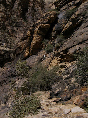
Showing posts with label Red Rock. Show all posts

Saturday, January 17, 2009

Grand Staircase in Calico Basin

It's the middle of January and the temperatures are in the 60s. This is why I live in Las Vegas. The Meetup group scheduled a short hour and a half hike up Grand Staircase in Calico Basin at 9:30am, which gave me enough time to hike before my golf lesson. It was warm enough for people to be in sleeveless shirts and shorts (though I'm still a wimpy Floridian and had on long sleeves and pants), and there wasn't a cloud in the sky.

Some of the 44 people on the hike starting up.
There's still some snow on Bridge Mountain. It was great hiking with Rick again after a several month break.

Tuesday, December 16, 2008

Red Rock Snow

I opened my blinds this morning to see that the sun had come out and all of the mountains were covered in snow. As soon as I had a free minute, I drove over to Red Rock. The views were simply stunning. I'm not sure if I've ever seen anything so beautiful. The sun was making the snow glow, and bits of red were peeking out of the rocks. It was quite crowded with people taking pictures everywhere. Here are some of my favorites, plus a video. More pictures here.

Monday, March 24, 2008

Exploring with the Brits

After three days on the Strip, I was sure Jan, Maurice, and Ann were ready for a change of scenery, so I took them up to Mt. Charleston for breakfast at the Mt. Charleston Lodge. This was a risky proposition as it was Easter, and the last time I attempted to eat here on a holiday, it took two hours just to order. Fortunately, we arrived at 9am and there were many empty tables. They had a fixed price menu with four choices, and we each ordered a different plate. Breakfast was fast and the view was amazing. It was a perfect day and not too cold despite there being snow on the ground. My guests couldn't believe that a place with so many trees could be so close to Las Vegas. Ann remarked as she was getting out of the car, "It's so quiet here!"
After breakfast, I drove to Red Rock for a complete juxtaposition of scenery. The group loved the color of the rocks and the stunning mountains. We went through the visitor's center, took some pictures, and drove around the scenic loop. They remarked that they could understand why I love living here, and they had smiles on their faces all day! This "eat at Mt. Charleston then tour Red Rock" itinerary is one that I will have to do for all guests that come to town.

Saturday, February 23, 2008

Magic Mountain

Branch Whitney, of Hiking Las Vegas fame, has been organizing some challenging hikes for the Meetup group with lots of scrambling and exposure (my two favorite things). I've been aching to do one of his hikes because he always limits them to 12 or so people, but I've been too busy with guests and travel. I finally got to go with his group on the hike up Magic Mountain, the mountain on the right in the picture below. It was a challenging hike with some great chimneys to wiggle up.

There was a saddle near the top that opened into a breathtaking view of Pine Creek Canyon. Bridge Mountain is above me in the picture below.
I wanted to say that I summitted Magic Mountain, so I climbed up this massive boulder at the top.
Unfortunately, I then had to climb down it. It's always more difficult going down. There were no handholds, so Eric got out a rope while Doug tied it around his waist and supported me going down. It helps to hike with capable strong guys.

Sunday, February 10, 2008

Kraft Mountain Attempt

Mike and I attempted Kraft Mountain, which is right past Calico Hills in Red Rock. We didn't know the route, but we were told to head straight back towards the mountains. That's what we did, but about two-thirds of the way up we came to a vertical wall and had to give up on the summit.
The whole climb up I kept saying that I wouldn't come back down this way, but I had no choice, so the climb down was a little bit tricky.
So we decided to hike around Kraft Mountain instead. There is a great wash that goes behind the mountain. I plan on taking the dogs back there sometime because the scrambling is limited.
We didn't know where the trail was to get back to the cars, so we hiked over the west side of Kraft Mountain, which had rocks full of swirling colors.

Thursday, January 24, 2008

Red Rock in the Snow

It amazes me that this place that is 100+ degrees in the summer can get snow on it in the winter. I love looking out the window and seeing snow, but not having to shovel it.

Monday, September 3, 2007

Scrambling at Calico Basin

Mike, Kristin, and I spent Labor Day scrambling at Calico Basin, one of my favorite hiking spots. It was a beautiful day. The last picture of the bee won me first prize in my hiking group's photo contest - I got free Jimmy Buffett tickets!


Sunday, June 10, 2007

Bridge Mountain Attempt

The weather here has been considerably cooler this week (highs in the 80s and 90s instead of triple digits), so four of us from the hiking group decide to take advantage of the weather and hike at Red Rock (which is usually too hot for a hike in the summer). We decided to try to summit Bridge Mountain, the second tallest mountain in Red Rock at 6940 feet above sea level. There are several approaches to Bridge Mountain, the most popular of which requires a high clearance vehicle to access the trailhead. None of us had such a vehicle, so we decided to try the path through Pine Creek Canyon. We found a website of a couple who had made it up this way, so we knew it could be done. We met at 7:30am and began our hike. The Pine Creek trail is a simple dirt path for the first 1-1.5 miles, beginning at about 4000 feet above sea level. At Mescalito, the trail forks. Our path was the right fork into Fern Canyon.


Starting out on the dirt path, approaching Mescalito in the middle:
Fern Canyon was beautiful. Water flowed in a creek and it was surrounded by thick vegetation. Because of all of the trees, it was much cooler in here. Eventually, the canyon became drier with fewer trees and plants, and the class 3 scrambling began. See how happy we are to come to boulders:
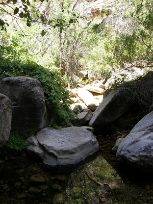
Here I am climbing up some boulders:
At first, the boulders were pretty simple to get over, but eventually we came to a steep wall. Rick and Parnell decided to scale the wall, but Mike and I found a path up some boulders to the right of the wall. Here I am at the top of the wall:
At the top, the view overlooking Pine Creek Canyon was beautiful. At this point, there was no longer a clear trail. The wash continued, but we decided to start up the canyon wall. There were cairns every so often to let us know that we were heading in the correct direction. Here is the view as we looked ahead. We were trying to get to the top of the ridge directly ahead so that we could begin the trek over to Bridge Mountain. We were pretty high up at this point on slick tilted rock. Going up seems so easy, but it's intimidating as soon as you look down to see where you came from. Eventually, we stopped seeing the cairns and no longer knew which way to go. Parnell tried one direction, but it was a nearly vertical wall that made even him nervous. Mike tried another direction, but the footholds ran out and he had to come back. Here is Mike, the dot in the center of the picture, trying to find a route for us.Alas, we had been hiking for four hours and decided to give up. We figured that this route was just too difficult to do without equipment. We had an awesome time bouldering, but the summit was not meant to be for this day. We made it back to the car six hours after we started, and we went out for a much-needed lunch.

When I got home, I looked at the website of the couple who had taken Pine Creek to get to Bridge Mountain. It turns out that if we had stayed in the wash, we would have found an easier route up to the summit. Looking at their topo map and GPS route, we had made it about 2.5 miles in, and we only had about 1.5 miles to go. We had ascended about 1500 feet of the 3000 feet to the summit. There's no telling how long it would have taken to finish that last mile and 1500 feet elevation gain because the route was just going to get scarier, but it's disappointing that we were so close to our goal. Next time the temperature cools down, we will try this peak again, perhaps with a different starting point.

Click here for more pictures from our hike

Saturday, June 9, 2007

Mother's Day Weekend Recap, Part III

On Monday, I took the day off to spend with Mom. We packed a lunch and headed to Red Rock Canyon. It is a conservation area west of the valley where the rocks and mountains have an incredible red color caused by rust. It is breathtaking to see, and it's my favorite place to go hiking.

We started at the visitor's center, where they had displays on the geography and history of the area. They also had some critters indigenous to the area, including this cute iguana.
Out by the car, the sweet ground squirrel posed for me.
There's a 13 mile one-way loop around Red Rock, with many spots to pull off and explore. Here is Mom at Calico Hills, where I often go hiking. Clearly, she was not here to hike in her white pants!
We stopped at Willow Springs and ate our lunch in a nice picnic area. It was very hot (near 100-degrees), but we were shaded by trees. We watched several squirrels and birds scamper around during lunch.
After finishing the drive, we went to Ethel's Chocolate in Henderson. That is Ethel M as in the Mars chocolate family. We went on a tour through the factory, sampled some chocolates, and Mom picked out some gifts to bring back to friends (sure beats a T-shirt!). Then we walked through the cactus garden outside. This is such a neat collection of cactus and other plants that can survive in the desert climate. In the winter, they decorate the plants with Christmas lights.