 We started on the North Loop trail at about 8:15. I love the atmosphere when starting a hike because it is cool and peaceful, though we did pass several people who were on their way back down the trail. Shortly after starting, we found a cool tree and took each other's pictures in it.
 After about 2 miles, we reached a high point where we had a nice view over Kyle Canyon and a clear view of our destination.
 About a half mile from there, we reached the Raintree. This is a Bristlecone Pine that is 3,000 years old.
 In about another half-mile, we reached Mummy Springs. We walked up to the springs to relax and have a snack. We came across two men with their dogs, and I overhead them speaking French to each other. They sounded French Canadian to me, but their accents were much clearer to understand than most French Canadians I've heard. I asked them, in French, if they were Canadian. They said they were from Montreal, and we spoke for a few minutes. I haven't had an opportunity to speak French for a while, and these guys made my day.
 From there, we started the one mile ascent to the summit. I kept pulling the Hiking in Southern Nevada book out to figure out the way. It said to hike up to three successive walls, following them to the right, until a dry wash. Then follow the wash up to another wall, follow it to the left, and hike up to the saddle. A last scramble would lead us to the peak. These directions were very difficult to follow - at one point, it said to hike up to a Bristlecone Pine, and there were literally thousands of those surrounding us. So we just kept going uphill. Much of the way were were on dirt, and it was difficult to get our footing. Other parts were on limestone, and those were much easier to climb.
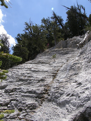 Finally, at about noon, we made it to the summit. We signed the register and figured we would be the only people at that peak today. It's neat knowing that this peak is less frequented than most in the area.
 The view from the peak was awesome. We could see all of the Vegas valley, Kyle Canyon, Lee Canyon, and the surrounding mountain ranges. We spent about an hour at the top eating, chatting, and taking in the views.
 Click here for a panoramic view from the summit.
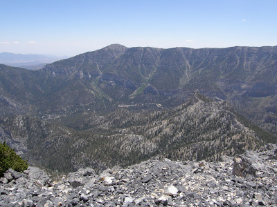 The hike down was much easier than going up. During the steep parts on dirt, we just slid down rather than taking steps. I lost my balance several times, but it would have been much more frequent if I hadn't had my trekking poles.
 After we got below the first of the series of walls, we noticed a trail on the other side of the wash, through which we were to descend. I was not looking forward to retracing our path because it was difficult to find good places to step on the way up, and I though gravity would not be friendly on the way down. So I suggested we take the trail and see where it went. Fortunately, after a series of switchbacks, we found ourselves back at Mummy Springs. I noticed at Mummy Springs that the trail appeared to continue, though the book told us to go straight uphill at that point. If we had continued on the trail, we would have found this much easier route up to the last wall. I would recommend that hikers ignore the directions in the book and to continue on the trail past Mummy Springs until it ends. At that point, follow the last wall till it ends on the left, and go straight up from there.
We finally got back to the car at about 5:00. We were on the trail for 9 hours, considerably longer than expected, but we did a fair amount of stopping to rest, snack, and take pictures in trees and such. This was a great trail, and I would definitely do this hike again.
Here's a picture of downtown Las Vegas through the trees. Click here for more pictures from the hike


No comments:
Post a Comment